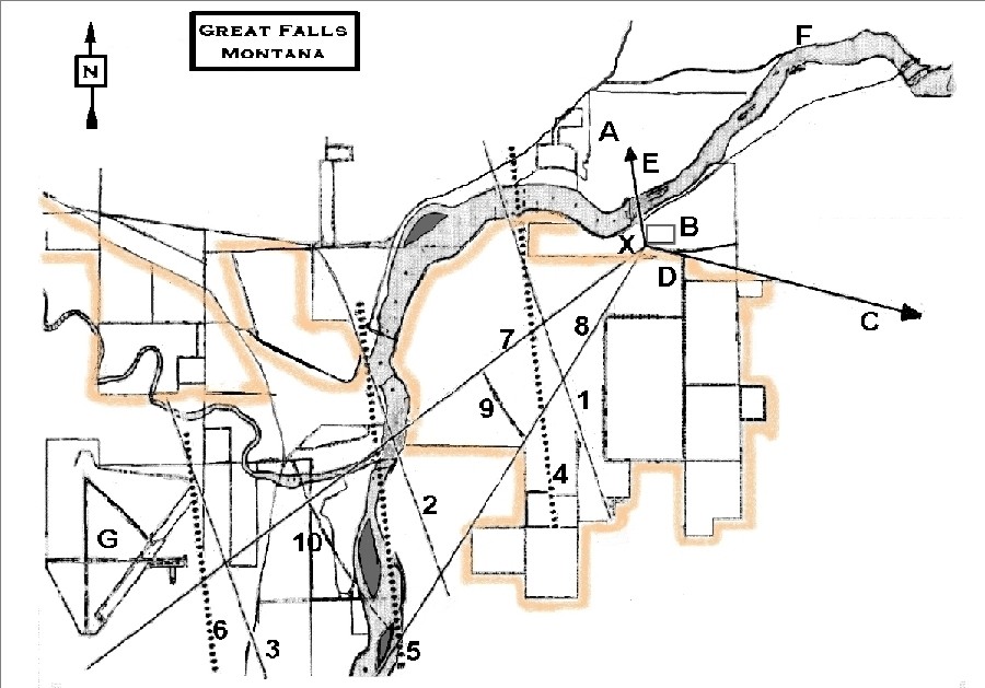
Figure 4
Map of Great Falls, Montana and vicinity, with built-up areas
outlined in color.

|
|
LEGEND
|
|
|---|---|
|
X - Observer A - First Sighted B - Ball Park C - To Malmstrom AFB (3 mi) D - Water Tower E - To Anaconda Smokestack F - Missouri River G - Airport |
1,2,3 - Sun Azimuth at 11:30 A.M. (154 deg) 4,5,6 - UFO Directions of Travel 7 - First Photographic Observation 8 - UFO System Disappears from View 9 - 2-Mile Radius 10 - 4-Mile Radius |
NCAS Editor's Note: This map, as displayed in the record of the symposium, was filled with extraneous clutter that sigificantly reduced the readability of the map. Most of this clutter consised of streets and buildings in the built-up core of the city. We have edited this detail out of the map, leaving the UFO sighting data in place and unaltered. The color outline indicates most of the areas within which clutter removal was necessary.Click HERE for full size image as originally scanned.